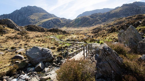
Marloes Peninsula coastal walk

Explore this beautiful heathland peninsula on the Pembrokeshire coast, surrounded by wildlife such as seals, seabirds and porpoises. This circular route takes you across farmland, along the Wales Coast Path and through the remains of Iron Age forts.
What is the Deer Park?
The area at the far end of the peninsula is named after a failed attempt to establish a deer park in the late 18th to early 19th century. It’s the site of an important Iron Age fort, and is the best place to spot baby seals in late summer.
Total stages: 7
Total stages: 7
Start point
Marloes Sands car park, grid ref: SM789082
Stage 1
From the south end of Marloes Sands car park, turn right by the emergency phone, following signs to the toilets. Continue along the lane and as you pass Marloes Mere look out for wetland birds. Past the Mere, turn left towards the coast path. The popular beach of Marloes Sands is covered at high tide. Gateholm Island, to your right, is a prehistoric settlement only reachable at low tide.
Stage 2
On reaching the coast path you'll see Marloes Sands to your left. Turn right, however, and continue towards Gateholm Island. As you come level with Gateholm, Skokholm is ahead of you with Skomer coming into view on the right.
Stage 3
Continue along the coast path and through the Iron Age fort. Enjoy the dramatic sedimentary rock formations along the coast. Skomer Island and Midland Isle gradually come into view. Grassholm, white with gannets in summer, can be seen on the horizon from the site of the Iron Age fort.
Stage 4
Continue along the coast path around the deer park (the end of the Marloes Peninsula). Follow the path up to Wooltack Point for views across to Skomer and St Davids Peninsula.
Stage 5
Go through the gate onto the road and turn left towards Martin's Haven and the Skomer embarkation point. Just before the beach, follow the coast path right and up the steps. The path continues east, with St Bride's Bay to the left and West Hook Farm to the right. Enjoy the magnificent views across St Bride's Bay towards Newgale, the Solva Coast, St David's Peninsula and Ramsey Island.
Stage 6
After just over a mile (1.6km), leave the coast path, turning right through a self-closing gate and past a West Hook Farm National Trust sign, then cross three fields to reach the road.
Stage 7
Turn left and walk along the road past Trehill Farm. Just over 400yd (400m) past the farm, turn right by two semi-detached cottages and down the track leading back to the car park. (Just over 100yd (100m) past the turning, a track to the right leads to another hide overlooking Marloes Mere.)
End point
Marloes Sands car park, grid ref: SM789082
Trail map

More near here

Martins Haven – the deer park walk
A short but spectacular walk around the end of the Marloes Peninsula with lots of seals (pups in autumn), heather and wildflowers, spectacular rocks and sea views.
Get in touch
Our partners

We’ve partnered with Cotswold Outdoor to help everyone make the most of their time outdoors in the places we care for.
You might also be interested in

Cotswold Outdoor: our exclusive walking partner
Learn about the National Trust’s ongoing partnership with Cotswold Outdoor. Find out how they help us care for precious places and the exclusive discount available for National Trust supporters.

Staying safe at National Trust places
The special places in National Trust care sometimes come with a few risks for visitors, be it coastline or countryside. Find out how to keep safe throughout your visits.

Follow the Countryside Code
Help to look after National Trust places by observing a few simple guidelines during your visit and following the Countryside Code.

Visiting Marloes Sands and Mere
Get closer to nature with birdwatching on the Mere and savour the seaside sights at Marloes’ beautiful beach. Or go further afield and explore the islands off the Peninsula.

Coastal walks in Wales
Discover the best walks along the Welsh coast, taking in picturesque peninsulas, rugged headlands, quaint hamlets, prehistoric monuments and outstanding wildlife.

Walking
Explore some of the finest landscapes in our care on coastal paths, accessible trails, woodland walks and everything in between. Find the best places to walk near you.

Walking in Wales
Explore wide open landscapes, gentler coastal strolls or energetic hikes for something a little more challenging. We've rounded up some of the best places to walk in Wales.