Skip to content

Discover the National Trust Land Map

View from Centenary Viewpoint, Dinas Oleu, Wales
The land Dinas Oleu was the first donated to the National Trust in March 1895 | © National Trust Images/John Miller

The National Trust Land Map is a fascinating mapping tool that illustrates the land the Trust looks after, when it was acquired, the location of war memorials, and more. It shows how the variety of places the Trust looks after has increased over time since 1895, and celebrates the generosity of our many benefactors and donors. Use it to explore our history or learn more about the places closest to you.

Land history and war memorials

The land history view displays the area of acquisitions in 20-year bands, showing our growth since 1895. You can click on a highlighted area of land to find out more about that acquisition, from how it was funded to who the original owner was.

The war memorials view shows you the story behind the approximately 170 memorials on our land, and a further 140 memorials which are connected with our places, the donor families or estate workers.

Getting started

The Land Map is an easy way to explore National Trust history. To get started, search by postcode, address or the name of a place, or you can just browse the map and zoom in to the location you’re interested in. You can then:

  • Use the map's first icon (layer list) to tick whether you want to show war memorials, disposals, land history or leasehold information on the map. Using this icon, you can also choose to see whether land is always open or if there is limited access.
  • Filter the land history and leasehold data by the date range you’re interested in, using the filter icon.
  • Change the style of the map you're viewing, from street map to terrain view and more.
  • Click on an area of land or war memorial symbol to find out more. Sometimes a place may have multiple records, so look out for the number of pages, displayed at the bottom of the entry.

Understanding the key

When you're selecting whether you want to view land acquisitions or war memorials, if you expand all the options, you’ll see a key, showing the symbols used in the map.

For instance, the colour of the land shows you the date range in which it was acquired, and war memorials are marked with a red or black poppy, depending on their location.

For more advice on using this tool, the question mark icon allows you to discover more about how to use the Land Map.

View the map

Further information

Land History map (layer)

  • The information in the map shows the land acquisitions made by the National Trust from its beginning in 1895 to the current date. Please note, information in Land Map is updated based on the Annual Report which is published every September. Due to the process of registering land and updating internal databases, new acquisitions could take up to 12-18 months before they appear in Land Map.
  • The boundaries shown in the map don’t represent the National Trust’s legal ownership boundaries and can’t be used for this purpose.
  • Only freehold acquisitions are currently shown, but the National Trust also leases some land and holds restrictive covenants and rights over other land (this imposes a restriction on the use of land, so that the value and enjoyment of neighbouring land will be preserved).
  • National Trust properties are often a collection of separate land acquisitions, and acquisitions include purchases, gifts, legacies and occasionally land swaps.
  • As a large portion of the National Trust’s land is leased to tenants, particularly tenant farmers, the public may have no right of access, except by public right of way.
The Boer War memorial on Coombe Hill in the summer with purple flowers in the grass
There are approximately 170 war memorials at National Trust places | © National Trust Images/Hugh Mothersole

War Memorials map (layer)

  • The majority (approximately 170) of the war memorials are on or inside National Trust properties. We are responsible for caring for most of the memorials, but some are cared for by local community organisations, a religious organisation, or under another arrangement.
  • The remainder of the memorials (approximately 140) have an historic connection with a National Trust property. For example, either the Trust or the then owner has contributed land, or the owner sponsored the construction of the memorial, or in some cases there’s a connection between the owner, family members, tenants or estate workers with someone named on the memorial.
  • Some memorials are accessible by public right of way, but those inside buildings or in the grounds of National Trust properties are only accessible during opening hours. It’s also worth noting that the few which are inside tenanted properties are not accessible to the public.


The War Memorial symbol has been sourced from www.flaticon.com and created by Freepik.

Contact us

Email

If you spot any errors with the map, please contact us on:

OpenData@nationaltrust.org.uk
A group of young adults kicking up autumn leaves on a walk around the estate at Hardwick, Derbyshire

Become a member

Join today and help protect nature, beauty and history – for everyone, for ever. Enjoy access to more than 500 places with National Trust membership.

You might also be interested in

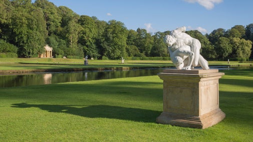
The restored statue of the Wrestlers at Fountains Abbey and Studley Royal Water Garden, North Yorkshire.
Article
Article

Sporting history in the collections we care for 

Taking part in sports is a popular pastime all over the world. From the origins of the Olympics to the evolution of cricket, discover sports through the ages at the collections and places we look after.

Oil painting on panel of a Young Girl holding a Chaffinch
Article
Article

Highlights from 100 paintings in the collections we care for 

The 13,000 oil paintings in our care are nearly all displayed in the houses of their historic owners. Learn about the stories behind a selection of the artworks and their owners.

Summer sunrise at White Sheet Hill, Stourhead, Wiltshire
Article
Article

History of summer solstice traditions 

Learn the ancient origins, traditions and folklore of the summer solstice and discover how midsummer was celebrated in millennia past at some of the places we care for.

A group of visitors standing outside the East Front at Tyntesfield, Somerset
Article
Article

What is Gothic Revival? 

Discover how it became popular in the 18th and 19th centuries to style literature, architecture, art, music and more after the features of the late medieval Gothic period.