Skip to content
A path through trees in the woodlands near Mottisfont, Hampshire
A path through Mottisfont estate woodland | © National Trust Images/Hugh Mothersole
Hampshire

Mottisfont estate walk

Discover the diverse Mottisfont estate on a varied walk through ancient woodlands and historic farmland. This walk takes in part of the Test Way and showcases some of the best of Hampshire countryside. Look out for fingerpost signs and way markers to guide you along the route. The route is designed to be walked anti-clockwise, but is waymarked in both directions. We have numbered the route to aid orientation.

Road walking

The route involves walking along some country lanes and roads with no pavements.

Total steps: 11

Total steps: 11

Start point

Spearywell car park, grid ref: SU316275

Step 1

Starting at Spearywell car park, take the gravel path next to the welcome board into the woods. Continue following the blue way markers until you reach a fingerpost sign. Follow the ‘Estate walk’ sign pointing left to reach Cadbury Junction.

Step 2

When you reach the Cadbury Junction sign, take the immediate path to the right. Keep following the blue 'Estate walk' way markers. Continue along this path, passing a woodland rest area on your right. The path gently slopes downhill and bends to the left. Continue on this path until you reach the boundary fence of Spearywell woods.

Step 3

Turn right, following the path until you reach the next way marker. Turn left here, following the woodland footpath and keeping the hedgerow to your left.

Step 4

Follow the way marker and continue straight. This single track path takes you past several fields. Halfway down the track, you'll continue to follow the path on an uphill stretch. At the top of this stretch you'll see a double-width metal gate that cuts across the path. Continue to the gate and take the pedestrian side access to reach a road called Keeper's Lane. On your left you'll pass a cottage and to your right, Keeper's Car Park (National Trust).

Step 5

Continue on Keeper's Lane, passing the Village Hall on your right. You'll reach a busy road junction – please take care. Turn right and follow the road (B3084), Hatt Hill. There is no pavement for the first 300m of the walk. Continue walking along the road until you reach a metal National Trust fingerpost sign pointing left towards ‘Mottisfont Abbey’. Cross over the road and continue to follow the blue Estate Walk way markers. This path is part of the National Cycle Network. Continue on this path for until you reach a way marker on your left.

Step 6

You have two options here. For a short cut, follow the light blue ‘Short Cut’ way markers: turn left through a metal pedestrian gate and cross the field diagonally until you reach a single pedestrian gate leading out towards a busy road, Mottisfont Lane. Immediately in front of you is a road and a brick wall with a way marker pointing left. Continue along this road, passing 'Benger's Lane' bus stop on your right and black iron wrought gates until you reach a road sign, ‘Oakley Road, Mottisfont’. The second option is a slightly longer route, which takes in the Millenium Orchard – an apple orchard which is home to several varieties of English apples. Follow the road past the orchard and old phone box until you come out on to Mottisfont Lane. Turn left onto Mottisfont Lane – this section of road is on a bend, with no pavement.

Step 7

Continue along Oakley Road, keeping a red brick wall to your right and cottages to your left. You'll pass a set of cream gates to your right as the road gently slopes downhill. Continue along the road until you reach a fingerpost sign on your right, signalling the Test Way, Estate Walk and other local trails. Follow the single track until your reach the end, which is marked by a National Trust ‘Mottisfont Estate’ omega sign. Turn left on to the road (Oakley Lane), following the way marked route for approximately 300m before turning right into a field signposted with a way marker.

Step 8

Turn left at Oakley Lane and head down the road for approximately 200m (218yd) before turning off the road at a field gate. Head round the gate and follow the path between two fields into the woodland. The path skirts around the edge of a woodland enclosure, before it turns right, and through open woodland. Carry on until the path turns off to the left leading out of the woods. To see the Oakley Oak, Mottisfont’s 800 year-old oak tree, you can turn right at Oakley Lane and head over the river. The oak is just off the ‘Oakley Beat’. Walk around the double black gates and take the vehicle track between two fields, following the way markers. Along the route you'll pass fencing to protect the coppice woodland from deer browsing on your left. Continue along this track, following the way markers along the route. Eventually you'll reach a boundary hedge with a way marker pointing left. Follow this route along the verges of the field edge. As you walk along the field verge, you'll see Mottisfont house and gardens in the distance. Keep following the path along the verge of the field until you come across a gap in the hedge line on your right hand side, identified by a way marker pointing right. Follow the arrow, leaving the field and head across the country road into the field opposite.

Step 9

Continue along the footpath, with open fields on your left and woodland hedgerows to your right. Keep straight on the path following the way markers for approximately 1km (0.6miles). You'll pass a Hampshire County Countryside Services access stile leading to various national walks on your right. Follow the path, bending left until you reach a black metal pedestrian gate with a ‘Mottisfont Estate’ omega sign. Enter through the gate and continue straight ahead.

Step 10

You’re now walking through a woodland called Great Copse. Keep straight ahead on the defined footpath, this stretch is roughly 800m (546yd) and should take roughly 10-15mintues to walk. As you approach the end of the woods, you'll see a double-width metal gate that cuts across the path. Continue to the gate and take the pedestrian side access, following the track towards a main road called 'Jerram’s Hill'. From here, turn left (please take caution on the road) following the way markers along Jerram’s Hill for approximately 170m (185yd) until you see a way marker on the right, pointing right. Take this little path to re-enter Spearywell Wood.

Step 11

Keep straight ahead until you reach a way marker bending off slightly to the right. This path will lead you back on to the main gravel track heading towards the car park. Here, turn left at the gravel track (stacked timber lines the path) and keep following the way markers - please be aware that heavy forestry machinery is often in operation in this area during the winter months. Keep right and make your way up a slight incline until you reach Spearywell car park.

End point

Spearywell car park, grid ref: SU316275

Trail map

Mottisfont estate walk trail map
Mottisfont estate walk trail map | © Crown copyright and database rights 2013 Ordnance Survey

You made it

Share your experience

More near here

Garden with river in foreground and house in background in winter, Mottisfont, Hampshire
Place
Place

Mottisfont 

A romantic house and gallery set in beautiful riverside gardens

near Romsey, Hampshire

Partially open today

Get in touch

near Romsey, Hampshire, SO51 0LP

Our partners

Cotswold Outdoor

We’ve partnered with Cotswold Outdoor to help everyone make the most of their time outdoors in the places we care for.

Visit website 

You might also be interested in

A family walking alongside Lake Windermere at Fell Foot during winter, Cumbria

Walking 

Explore some of the finest landscapes in our care on coastal paths, accessible trails, woodland walks and everything in between. Find the best places to walk near you.

A man and a woman enjoy the view whilst walking in the Peak District
Article
Article

Cotswold Outdoor: our exclusive walking partner 

Learn about the National Trust’s ongoing partnership with Cotswold Outdoor. Find out how they help us care for precious places and the exclusive discount available for National Trust supporters.

An aerial view of an adult and baby walking a dog along a path at Baggy Point, Devon
Article
Article

Staying safe at National Trust places 

The special places in National Trust care sometimes come with a few risks for visitors, be it coastline or countryside. Find out how to keep safe throughout your visits.

A visitor carrying a backpack and walking along a footpath at Divis and the Black Mountain with stone walls either side, the countryside visible in the background.
Article
Article

Follow the Countryside Code 

Help to look after National Trust places by observing a few simple guidelines during your visit and following the Countryside Code.
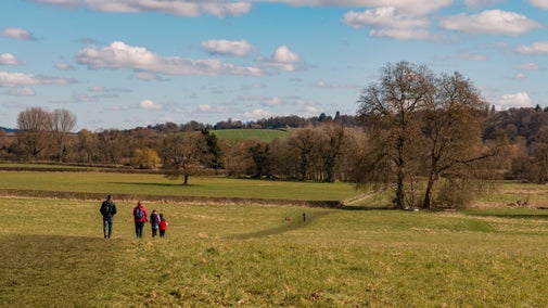
Field in foreground, trees in the background in autumn colour, Mottisfont, Hampshire
Article
Article

Explore the Mottisfont estate 

Explore Mottisfont’s diverse estate, traversed by the crystal-clear River Test, and south Hampshire countryside sites of Stockbridge Down and Marsh and Curbridge Nature Reserve.

Cappucino in the Orangery restaurant at Cliveden, Buckinghamshire
Article
Article

Eating at Mottisfont 

Treat yourself to a snack and drink at one of the cafés after a wander in the garden.

A small white dog walking on a muddy path
Article
Article

Visiting Mottisfont with your dog 

Mottisfont is a two pawprint rated place. Dogs on a short lead are welcome to explore most of the garden.
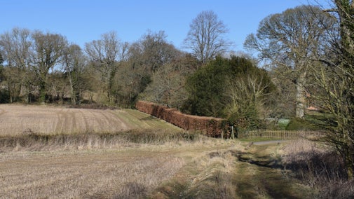
Rutted rack through arable field in winter with trees and hedges in background, Hinton Ampner, Hampshire

Walking in Hampshire 

There’s so much to enjoy on a winter's walk in Hampshire. You can wander through magnificent beech woods at The Vyne, or take in breathtaking views across downland at Hinton Ampner. We've got walks to suit all ages, including young families, with fascinating facts to accompany each one.