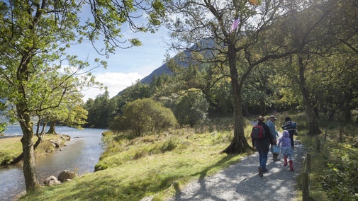
Lanthwaite Wood and Crummock Water walk

This walk passes through the hills and woodlands on the eastern side of Crummock Water. The route is dominated by two sweeping views: the famous vista of the Buttermere fells seen over the lake's far side, and the dramatic rocky buttress of Grasmoor End looming over its northern tip.
Total stages: 11
Total stages: 11
Start point
Lanthwaite Wood National Trust car park, grid ref: NY149215
Stage 1
Leave the car park through the wooden gate. Follow the forest road straight on, ignoring the left-hand fork. Walk through the forest with stolen glimpses of the meandering River Cocker below.
Stage 2
Stay on the main track, ignoring the left-hand forks, down to the lake. From the lakeshore, take the narrow ‘trod’ uphill through the trees. Turn right and follow the track as it gently climbs. On the right are views of the lake across to Mellbreak.

Stage 3
At the junction, turn right down towards the boathouse – a great spot for a picnic and a paddle. Then follow the path that continues into the wood along the lake edge. Go through a gate and over a ford and a stile. Here the path gets rough under foot.
Stage 4
At the end of High Wood, pass through a gate and follow the path ahead. Stay on this path as it hugs the lakeshore, passing through two gates and over three footbridges, until you come to a wall with no gate.
Stage 5
On reaching the wall, turn left and walk uphill to arrive at a gate. Don’t go through the gate – instead, turn left and follow the grassy path keeping the boundary wall on your right, heading back the way you came. Keep right at the junction, taking the higher path running adjacent to the wall. This path gives lovely views across Crummock Water.
Stage 6
Arrive at the edge of High Wood – a bench makes the spot where artist J.M.W. Turner made his sketches of the valley. Pass through the gate onto the road. Turn left and follow the roadside verge, keeping the wood to you left. Take care as the verge narrows in places.
Stage 7
Immediately after Lanthwaite Green, turn left over the stone stile marked by the public footpath finger post. Follow the track as it runs between the boundaries.
Stage 8
Where a wall crosses the track, pass through the kissing gate on the left. A slate footpath sign helps guide the way. Walk towards the wood ahead and through another gate. Go through the gate and follow the path that hugs the boundary wall to the next gate.
Stage 9
Either turn left onto the main path as it heads downhill back to the car park, or you can do an optional hike to see the viewing station at Brackenthwaite Hows. For Brakenthwaite Hows, at the gate keep straight on keeping the boundary wall on your right – the path narrows and winds uphill through trees to a narrow gate in the boundary wall.
Stage 10
Go through the gate out of the wood and keep following the narrow path uphill to a low summit. This is Brackenthwaite Hows. Enjoy the view then retrace your steps.
Stage 11
Follow the path downhill, ignoring forks to the left and right, until it re-joins the main forestry road leading back to the car park.
End point
Lanthwaite Wood National Trust car park, grid ref: NY149215
Trail map

More near here

Whitehaven colourful coastal walk
Experience wild, secluded beaches on this dramatic cliff-top walk at Whitehaven's historic 17th-century harbour, passing the town’s industrial archaeology to join Wainwright’s Coast to Coast path.

Buttermere to Rannerdale walk
This scenic and invigorating Lakeland ridge walk takes you from the Buttermere Valley up to the summit of Rannerdale Knotts, offering impressive views over lakes and high peaks.
Get in touch
Our partners

We’ve partnered with Cotswold Outdoor to help everyone make the most of their time outdoors in the places we care for.
You might also be interested in

Things to do in Buttermere Valley
Explore the Lake District's Buttermere Valley and discover walks through rugged landscapes, panoramic views, thundering waterfalls and other forces of nature.

Wildlife in the Buttermere Valley
Discover the wildlife you can spot in the Buttermere Valley. Learn how otters have returned and how rangers care for swathes of bluebells to protect them for future generations.

Staying safe at National Trust places
The special places in National Trust care sometimes come with a few risks for visitors, be it coastline or countryside. Find out how to keep safe throughout your visits.

Follow the Countryside Code
Help to look after National Trust places by observing a few simple guidelines during your visit and following the Countryside Code.

Cotswold Outdoor: our exclusive walking partner
Learn about the National Trust’s ongoing partnership with Cotswold Outdoor. Find out how they help us care for precious places and the exclusive discount available for National Trust supporters.

Walking
Explore some of the finest landscapes in our care on coastal paths, accessible trails, woodland walks and everything in between. Find the best places to walk near you.

Walking in the Lake District
From gentle ambles to more challenging hikes, these are some of the best walks to explore the heart of the Lake District.