Estate map of Blickling dating to 1729 conserved and now on display
- Published:
- 18 September 2024

A hand-coloured parchment survey map of the Blickling Estate and Parish, by James Corbridge dating to 1729, has returned this month after extensive conservation and is on display at Blickling Hall, cared for by the National Trust.
This is the only surviving historical plan of Blickling and is highly significant in terms of the social history of the estate, containing details of the landscape, walled garden, lake, mount, goose-foot avenues and tenancies of smaller parcels of land.
In March the map was sent away for conservation at Museum Conservation Services. Conservator Nicholas Burnett explained, “The first task was to remove the plywood, which the map had been adhered to in the 20th century – this proved tricky and time consuming. The starchy glue was strong, and the plywood had to be removed in stages, first with chisels, then a sander and finally picked off with scalpel and tweezers to reveal the back of the map. This delicate work took over 100 hours to complete.
“Next we cleaned the surface of the parchment, repaired the splits and tears, and remounted and reframed the map.”
When the ribbon edging was removed, the original yellow border and a black and white scale, painted by Corbridge in the bottom left corner, could be seen for the first time in 50 years.
Surface cleaning of the parchment removed some of the dirt and improved the overall appearance. Old repairs were removed and replaced with modern parchment patches.
An ingenious method of mounting the map has been devised, suspending it on hundreds of tiny strings that allow the parchment to flex and move.
This complex conservation work means the map is safe to display for many years to come, revealing the estate’s social and landscape history to countless visitors.

Corbridge Estate Map Conservation - removing the final plywood layer with fine chisels giving greater control | © Museum Conservation Services 
Corbridge Map conservation thread mounting - attaching the threads | © Museum Conservation Services
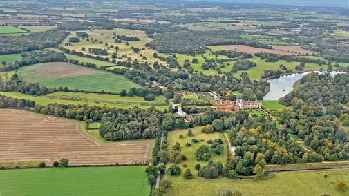
Blickling Estate’s Property Curator, Megan Dennis, explained, “John Hobart, 1st Earl, was passionate about Blickling and wanted to record his beloved estate. He employed James Corbridge, a young surveyor, to complete this fine, hand coloured parchment map of his land. The map shows how John completely re-organised the gardens and parkland in the early 1700s. He turned the axis of the estate west-east, created the lake and laid out the avenues, one of which we can still see today.
“It’s interesting to look at well-known features in the Blickling landscape such as the lake, which is labelled ‘New Pond’ on Corbridge’s map – back in 1729 it was only a third of the size it is today.
“The map also shows three avenues formed in the shape of a goose-foot, extending out from the west side of Blickling Hall. Corbridge shows a fourth avenue linking, via a small gate, to the road at Itteringham. Only one avenue still exists in the park today. Corbridge may have been drawing a new design for avenues, instead of recording what was already there.”

The map will be on display at Blickling Hall until 10 November 2024 as part of the Autumn Magic and Folklore event, telling stories of myths and legends of the estate. Early in 2025 the map will go into its’ new permanent location, to establish the importance of the house within the context of the wider estate.
The House is currently open 11am - 4pm, with last entry at 3.30pm. (Last entry will be 2.30pm with closure at 3pm from 1 November). Discover more about the Autumn Magic and Folklore event which runs from Saturday 21 September until 10 November: Autumn Magic and Folklore | National Trust

Discover the house at Blickling Estate
Discover more about Blickling Hall, in Norfolk, a Jacobean mansion thought to be the birthplace of Anne Boleyn, and sits in a historic park.

The history of Blickling Estate
Mentioned in the Domesday Book, the estate was the birthplace of Anne Boleyn, and during the Second World War RAF air crew were billeted here.

Explore the wider Blickling Estate
There's much more to Blickling Estate than its famous house. Covering 4,600 acres with 950 acres of woodland and parkland and 3,500 acres of farmland, Blickling Estate is great for exploring alone, with family or your four-legged friends.

