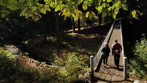
Wetland Walk, Cragside

Walk to Cragside's driest lake. Blackburn lake was once the largest expanse of water on the grounds before it burst its banks in 1927. This area is now a wetland making a great place for wildlife spotting. This walk has been listed as moderate but there is a short challenging section towards the end of the walk, around Cragend Quarry. A suggested diversion is suggested in step 7.
Follow the waymarkers
Orange waymarkers will show you the way on this walk.
Total stages: 11
Total stages: 11
Start point
Cragend car park, grid ref: NU0824601172
Stage 1
Park up at Cragend Quarry car park which is accessed via the Carriage Drive.
Stage 2
If you stand with the quarry wall in front of you, the starter waymarker is on your right. Follow this rocky, uneven path. There are some uneven rocks to navigate as you go uphill.
Stage 3
At the first arrowed sign, go right for the 'Thatched Boathouse'. You will be on this path for a while. Eventually this path comes out on to the Carriage Drive, next to Blackburn Lake. You will see the thatched boathouse on your left.
Stage 4
Follow the waymarkers to the right and walk along the Carriage Drive. Walk into Blackburn car park and bear left to follow the grass path.
Stage 5
Walk straight ahead, where you see Blackburn Dam on the right. This path bears left on the a barked chipped path. From here you'll get a sense of just how big Blackburn Lake was until it burst its banks. You'll soon seen the boathouse ahead of once more. Walk down the grass bank, back to the Carriage Drive.
Stage 6
You've completed the Blackburn loop, cross back across the Carriage Drive and walk on to the same path to take you back to Cragend Quarry.
Stage 7
After a fairly long stretch between rhododendron, trees and bracken, you'll come back to the junction. From here, go right, following signs for 'Viewpoint' and 'Lakes'. (This next part of the walk is reasonably challenging with a steep incline and uneven path. If you would prefer not to do this section your can turn left which takes you back to Cragend Quarry.)
Stage 8
Walk up the steep incline. This path soon levels out and bears left where you'll be greeted by the welcoming sight of a bench overlooking the Northumberland hills.
Stage 9
When you're ready to start walking again, follow the rugged path downhill which takes you between some trees and passed a huge boulder. At the next arrowed sign, go left following the direction for the Shepherd's Hut.
Stage 10
Follow the winding path downhill. The Shepherd's Hut will come into view on the right. Keep following the track. At the next post, bear left and following the winding path between the trees.
Stage 11
And finally, at the next sign go left back towards Cragend car park.
End point
Cragend car park, grid ref: NU0824601172
Trail map

More near here


The Armstrong trail, Cragside
A 2-mile circular walk along the Armstrong Trail at Cragside in Northumberland. Follow the water from Tumbleton lake through the Debdon Valley. Witness sparkling lakes, towering trees and tumbling cascades.

Nelly's Moss lakes walk, Cragside
Discover the historic lakes, engineered by Lord Armstrong as part of his pioneering hydro-electricity system, on this easy circular walk at Cragside, and spot wildlife like frogs and herons.

Building Cragside Walk
On this challenging hike you'll follow a rocky and hilly route. next to jagged cliffs and through stone tunnels on the way to Cragend Quarry.
Get in touch
Our partners

We’ve partnered with Cotswold Outdoor to help everyone make the most of their time outdoors in the places we care for.
You might also be interested in

Walking
Explore some of the finest landscapes in our care on coastal paths, accessible trails, woodland walks and everything in between. Find the best places to walk near you.

Walking in the North East
From a trek through the largest area of ancient woodland in Northumberland to a walk in the footsteps of the Romans along Hadrian's Wall, there are some amazing places to walk in the North East.

Cotswold Outdoor: our exclusive walking partner
Learn about the National Trust’s ongoing partnership with Cotswold Outdoor. Find out how they help us care for precious places and the exclusive discount available for National Trust supporters.

Staying safe at National Trust places
The special places in National Trust care sometimes come with a few risks for visitors, be it coastline or countryside. Find out how to keep safe throughout your visits.

Follow the Countryside Code
Help to look after National Trust places by observing a few simple guidelines during your visit and following the Countryside Code.

Things to do on the estate at Cragside
Stretching your legs in the cool winter air is a great way to blow away the cobwebs and recharge your batteries. You could re-discover some of your favourites hidden gems, or perhaps find a couple of new ones on a walk at Cragside.

Visiting Cragside with your dog
Cragside is a two pawprint rated place. With over 40 miles of footpaths, Cragside is great place to stretch your legs with your dog. Read our top tips to help make the most of your visit.

Shopping and eating at Cragside
Break up your day by visiting one of the eateries at Cragside, and pop into the shop, set in the old stable block near the tranquil Tumbleton Lake.