Edale Circular Walk

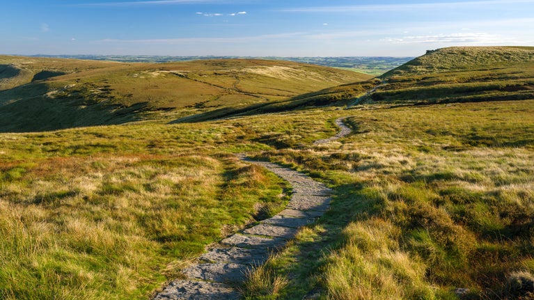
This low level walk leads you through vast, open fields and along parts of the Pennine Way, following streams and stone-flagged paths through the Vale of Edale.
Plan ahead
Popular spots like Kinder and Edale are getting extremely busy, especially at weekends, Bank Holidays and during the school holidays. Many car parks fill up very quickly by 9am, so do plan ahead before leaving home. Please park safely and considerately in designated spaces and not on roads or grass verges, as this can block access for farm tenants, local residents and emergency services. Barbecues and campfires are not permitted.
Total stages: 7
Total stages: 7
Start point
The Penny Pot Cafe, Station Approach, Edale, Derbyshire S33 7ZA.
Stage 1
Facing the Penny Pot Café, turn right and walk to the end of the road before turning left at the T-junction. Pass under the large railway bridge and continue north along the road heading towards Grindsbrook Booth (approx. 700m), passing The Rambler Inn on the left.
Stage 2
Passing the Moorland Centre on the right, and then Edale Church on the left along this road, continue until you can see the Old Nags Head pub ahead. Then take a left after New Fold Farm and join the Pennine Way (not the signposted public footpath). Follow the Pennine Way for approximately 2.6km, walking by a stream on your right gently uphill.
Stage 3
After passing through the gate at the top of the hill, turn left through another gate, still signposted Pennine Way, and follow the stone-flagged path. Beware of stock grazing here, especially those with young, which are best to skirt around. If you have a dog on a lead and cattle show an interest it's often best to let the dog off the lead to run free. Continue along the stone path through the fields.
Stage 4
The path will eventually start to descend, winding between two hillocks. After a gate you will pass a ruined farm building on the left. At the bottom of this path follow the rough track on the right which leads onto a lane. Before reaching a farmhouse and its out-buildings, leave the Pennine Way, joining a Public Footpath on your left (SK104854). Continue along this footpath for approximately 1.3km.
Stage 5
As you pass through these fields you'll cross two stone bridges and one wooden one. You'll then cross over a railway bridge. After this, follow the lane through the farm buildings and cottages and you will pass Edale Methodist Chapel on the left. At the T-junction turn left passing Bakers Fold Cottage. Continue approximately 80m on the road side then join the path signposted for Edale Station on your left. Continue on this path for 700m, passing back over the railway bridge.
Stage 6
After crossing the railway bridge, turn right through a gate and after the next gate, follow the path to the right along the edge of the field. You will pass through three grazing fields after this gate. When leaving the fourth field, turn right onto a concession path following signs for Edale Station for approximately 700m.
Stage 7
After the second gate, cross the railway bridge once again and turn left. When the gravel road bears right keep to the left of the field, signposted to Edale Station once more. Follow these signposts until you reach the station. The Penny Pot is located just past Edale station car park, along the road on the left.
End point
The Penny Pot Cafe, grid ref SK123853
Trail map

More near here

Kinder Scout mass trespass walk
Follow in the footsteps of the 500+ mass trespassers who, in 1932, walked from Hayfield to Kinder Scout in the Derbyshire Peak District to secure access rights to the countryside for all.

Mam Tor circular walk
This circular walk from Mam Tor in the Peak District takes in some of the most dramatic scenery in the Edale Valley.

Below Kinder Scout: A circular walk around Kinder reservoir
This 5.2-mile circular walk takes in the tree-lined avenues around Hayfield as well as the heather-covered moors of Kinder Scout and the reservoir.

Derwent Valley and reservoir walk
This walk takes you through key Peak District habitats including farmland, alongside the Ladybower Reservoir and up to the moors for panoramic views of the High Peak.
Get in touch
near Hope Valley, Derbyshire, S33 8WA nearest postcode area
Our partners

We’ve partnered with Cotswold Outdoor to help everyone make the most of their time outdoors in the places we care for.
You might also be interested in

Walking and cycling in Kinder, Edale and the High Peak
Discover the best views of the Peak District on a refreshing walk or bike ride through Kinder, Edale and the High Peak in Derbyshire.

Things to see and do at Kinder, Edale and the High Peak
Discover breath-taking views of the Peak District, natural landscape features and the best spots for wildlife watching at Kinder, Edale and the High Peak.

Visiting the Peak District with your dog
Walking with your dog is a great way to enjoy the scenic walks and stunning views of the Peak District. Here is some information and guidance about visiting the area with your dog.

Cotswold Outdoor: our exclusive walking partner
Learn about the National Trust’s ongoing partnership with Cotswold Outdoor. Find out how they help us care for precious places and the exclusive discount available for National Trust supporters.

Staying safe at National Trust places
The special places in National Trust care sometimes come with a few risks for visitors, be it coastline or countryside. Find out how to keep safe throughout your visits.

Walking in the Peak District and Derbyshire
Discover the best walking routes around the Peak District and Derbyshire for walkers of all abilities, from peaks and lakeside paths to expanses of moorland.