The Long Mynd and Ratlinghope walk

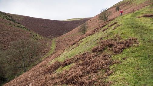
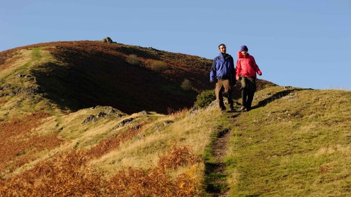
A challenging circular walk taking in both sides of the Long Mynd with a route around the quieter, west side of the hill. The trail passes a waterfall and follows a section of the Shropshire Way as well as a Stone Age pathway with plenty of interesting geology to spot along the way. It's a long hike so stop halfway at the Bridges pub for a picnic or refreshments.
Check weather
Take appropriate clothing for the weather. This walk may not be suitable in the winter, please take note of any warning signs.
Total stages: 11
Total stages: 11
Start point
Carding Mill Valley, grid ref: SO445945
Stage 1
If you are starting from the Chalet Pavilion, follow the stream uphill to the former top car park. Continue up the valley on the stony track to the left side of the stream. When the valley divides 500 metres later, take the left-hand fork, up crude 'pitched' stone steps into the narrow Lightspout Hollow.
Stage 2
On reaching the waterfall climb up the steps alongside it. Follow the path up the main valley keeping to the left as it climbs upwards. Continue to follow this path as it curves around the hill, ignoring the dip to the right until you meet a green track leading gently up to the right. This will take you to the Port Way where you bear left through some posts and follow the main track to Shooting Box.
Stage 3
You will reach a car park and road, here turn right, cross the road and then immediately half left down the track. Follow the track past Priory Cottage and continue onto Coates Farm.
Stage 4
At Coates Farm turn right at the sign for Bridges through the farmyard. Follow the house round to the right, go across the two cattle grids, then go straight down the hill, keeping the hedge on your left hand side. You will soon come the The Bridges pub.
Stage 5
The Bridges is a great place to stop for lunch, either for a picnic or at the pub. Turn right out of the pub, then immediately right again up the road past the YHA.
Stage 6
At the bridge, take the gate on the left hand side signposted 'Shropshire Way'. Follow the well-marked track alongside the river via several gates and stiles. Keep the river on your right hand side.
Stage 7
Near Lower Darnford Farm take the left hand track signposted 'Darnford Walk'. After 300m, cross the stile and follow the Shropshire Way signs.
Stage 8
Keep heading uphill until you reach a gate leading to the northern section of the Port Way. Turn right and follow this track gently uphill. This section of the route provides fantastic views north to Shrewsbury and beyond.
Stage 9
Stay on the main track for approximately 1,500m until you meet the road, then turn right.
Stage 10
Bear left on track, you are back on the Portway.
Stage 11
Turn left down Mott’s Road and descend back into Carding Mill Valley. Cross the stream at the confluence and then head downstream towards the top car park.
End point
Carding Mill Valley, grid ref: SO445945
Trail map

More near here

The Burway Loop: a walk to the top of the Long Mynd
Take a challenging walk from Carding Mill Valley up to the highest point of the Long Mynd, which offers impressive views across Shropshire and beyond.

Lightspout Waterfall walk
Starting at Carding Mill Valley at the heart of the Long Mynd enjoy a sometimes challenging walk along a stream to the 4-metre cascade at the picturesque Lightspout Waterfall, taking in impressive geology and wildlife along the way.

Reservoir walk
This shorter walk through the valley ends with beautiful views of the reservoir and beyond.

The Pipe Walk at Carding Mill Valley
This walk is a great way to see some beautiful views and also to really get to the heart of 'those blue remembered hills', as mentioned in the poem by A E Housman.
Get in touch
Our partners

We’ve partnered with Cotswold Outdoor to help everyone make the most of their time outdoors in the places we care for.
You might also be interested in

Outdoor activities at Carding Mill Valley and the Long Mynd
Enjoy the great outdoors at Carding Mill Valley and the Shropshire Hills. Find out about the best routes and keeping yourself safe while out walking and cycling on the Long Mynd.

Things to do at Carding Mill Valley on the Long Mynd
Explore the great outdoors at Carding Mill Valley and the Long Mynd. Enjoy a bracing walk, a challenging bike ride, a wild swim, have fun with the family or just take in the views.

Visiting Carding Mill Valley and the Shropshire Hills with your dog
Carding Mill Valley is a one pawprint rated place. Explore miles of footpaths and open countryside with your dog at Carding Mill Valley and the Shropshire Hills. Find out how to keep the wildlife and your dog safe on your visit.

Cotswold Outdoor: our exclusive walking partner
Learn about the National Trust’s ongoing partnership with Cotswold Outdoor. Find out how they help us care for precious places and the exclusive discount available for National Trust supporters.

Staying safe at National Trust places
The special places in National Trust care sometimes come with a few risks for visitors, be it coastline or countryside. Find out how to keep safe throughout your visits.

Follow the Countryside Code
Help to look after National Trust places by observing a few simple guidelines during your visit and following the Countryside Code.

Walking in Shropshire and Staffordshire
Find out about the best walking routes around Shropshire and Staffordshire, including gardens, parkland and estates, ideal for family walks.