Standen to Selsfield Common walk

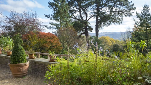
Starting at Standen House, this 8.5-mile walk is ideal for experienced walkers. The route takes you around Selsfield Common, a heathland habitat of the High Weald Area of Outstanding Natural Beauty (AONB), along country paths and through wildlife-rich woodlands.
Shortening the walk
If you wish to shorten the walk, there are bus stops near Step 8 and Step 12 with regular buses that will take you back to Standen.
Total stages: 23
Total stages: 23
Start point
Main entrance, Standen, grid ref: TQ389357
Stage 1
From Standen main gate, walk up the drive to the cottages on the left. Take the footpath to the left of the cottages, next to the footpath fingerpost. This path follows part of the High Weald Landscape Trail. Follow the path, keeping the barbed-wire fence on the right.
Stage 2
Go through a metal gate and continue downhill, with a hedge on your left-hand side. Continue down a sunken path until you reach a fingerpost and information board. Keep walking ahead, don't turn right.
Stage 3
Continue down the slope and bear left at the fingerpost. Go down a steep slope through the scrub, through a metal gate into an open field and continue ahead towards the reservoir. You will see Standen Barn on the left-hand side. Continue down the field to the bottom by the reservoir, turn right and continue following the High Weald Landscape Trail. Continue along the right-hand edge of the field to a metal gate in the bottom corner.
Stage 4
Continue along this path, with the reservoir and chainlink fence on your left, until you reach a tarred lane. This is the old road which was submerged by the water to create the reservoir. It now leads nowhere and is and blocked by a padlocked double iron gate. Turn right at this gate and go uphill for a few hundred yards, before it turns left and levels off.
Stage 5
Turn right at the junction with the road. Please take care here as cars are often driving very fast and your visibility to them is poor. Continue for 50 yards (46 metres) uphill to the fingerpost. Opposite Stone Hill House, cross the road and proceed slightly uphill along a rough track. Follow the path above the rocks and continue until you reach a fingerpost and metal gate at the top of the hill. The track takes a bend to the right – follow it down to Mill Place Farm, past a fishing lake on the right-hand side.
Stage 6
Go past the fishing lake, over a brick bridge and continue ahead.
Stage 7
Follow the track under the Bluebell Railway bridge, ignoring the footpath to the left. Enter the woods and turn left onto a footpath. This leads across an asphalt road, through a kissing gate and into a field.
Stage 8
Walk beside the left-hand edge of the field and cross a bridge made from wooden railway sleepers. Follow the path (which is notoriously often muddy) between sedges in a woodland.
Stage 9
Cross a wide track (another notoriously muddy one) and keep going straight ahead. The footpath becomes very small and overgrown and can be easily missed. Eventually you will pass through an old broken metal kissing gate into another field.
Stage 10
Follow the left-hand edge of the field and turn immediately left when you reach a stony drive. You will see farm cottages up to the right. This deeply-rutted farm track leads past the end of the Gravetye Lake.
Stage 11
Follow the track out into a grassy field. Stay parallel to the right-hand woodland edge and go slightly uphill. When you reach a gap in the trees, enter another field and continue ahead to a fingerpost at the top of the field, passing a clump of oak trees in the middle of the field on your way. Here you can skip straight to Step 13 if you wish to miss the viewpoint.
Stage 12
Go through the gap in the hedge and up to the next field. You'll find a stile and sweeping views across to the distant North Downs and the grey square tower of East Grinstead church. After you've had your fill of the view, head back the way you came, towards the last fingerpost and the clump of oak trees halfway down the slope.
Stage 13
Keep to the left-hand edge of the field (with a clump of oak trees in the middle), and head towards the corner (you will see the grey buildings of Gravetye Manor in the distance). Leave the field and descend some basic stone steps, over two wooden planks and along the rough path down to another stile into another field. This area may be muddy and slippery downhill. The indistinct path follows the left-hand edge of the field, in which a small barn is visible up on the right.
Stage 14
Passing through clumps of bracken and gorse to your left, enter the woodland in the corner of this field. Keep left and follow the path past the lake, over a brick bridge and uphill alongside the wire railing on top of a low brick wall. Cross the private drive of Gravetye Manor and then cross the car park and staff quarters. Continue uphill through an anti-deer gate. Follow the track past a walled garden on the right to a bend by a fingerpost.
Stage 15
Turn right through another tall anti-deer gate and walk up a long, dark track under laurel bushes, between banks. After passing a back garden, carry on past a long, low brick farm building. Where the path levels out, it continues between rhododendrons to reach the private drive of Moatlands, on Vowels Lane.
Stage 16
Turn right onto a bend in Vowels Lane, marked by an upright wooden house signpost at the entrance of Moatlands. Cross the road, turn left and walk approximately 50 yards (46 metres) on the road.
Stage 17
At the kissing gate, just past Kingscote Kennels, follow a rough track through the woodland to a field. Walk along the straight, wide grassy track across the field towards the buildings. Walk through a kissing gate and across a private drive. You will pass two Wellingtonia pines as you go along a wide grassy path between two wood-and-wire fences. Walk through a small kissing gate beside a large wooden gate. You will see the National Trust Selsfield Common sign immediately in front of you.
Stage 18
This is Selsfield Common and the turning point for the return to Standen. Take some time to wander the paths and enjoy the views. If you follow the fingerposts in a straight line until you exit the wood, you see a memorial bench facing a field and a rewarding view over the Weald and Turners Hill. To return to Standen reverse the route from 17 to 15 until you reach the main entrance of Gravetye Manor car park and staff quarters.
Stage 19
From the main driveway, turn left and walk uphill along the road for approximately 200 yards (183 metres), following the High Weald Landscape Trail (HWLT) signs past the Garden parking sign 'P'. Turn right, head down towards Home Farm and continue on the High Weald Landscape Trail. Pass the farm buildings and keep going ahead. You'll pass a cottage, a metal barrier and a fingerpost (do not turn right down the lane). Go past several log piles and on through Bushey Wood.
Stage 20
Follow the path until you reach a fingerpost. Take the path to the right which goes downhill past a pond on the right-hand side of the woodland track. At the bottom of the hill, keep ahead (ignoring right-hand track), go over a wooden bridge and continue uphill with pylons overhead. At a crossroads of footpaths and fingerpost, turn right and follow the path to to the main tarmac lane.
Stage 21
Turn right on the tarmac lane. Continue ahead and pass Brookbank and Holly Tree Cottages on the left-hand side.
Stage 22
Continue forward and keep on the tarmac road, past a wooden gate. At the fingerpost pointing left into the edge of the woods, (before Birch Farm) go through the wood, cross a stile and go up the steep bank of the Bluebell Railway embankment. Cross the railway line, down the embankment over a stile and follow the path through the woods to a gate towards pylons. Cross the field over a railway sleeper bridge, bearing right towards the next footbridge over a river. Carry on uphill through a gap in the trees towards a gate at the top of the field.
Stage 23
Go through the gate and bear right towards the sunken path. It will lead you to the rocks on the right-hand side and back to the main tarmac road. Rejoin the route back to Standen at Step 5 and reverse the circuit.
End point
Main entrance, Standen, grid ref: TQ389357
Trail map

More near here

Walk from Standen to Kingscote Bluebell Railway
Walk to and from Kingscote Station and Bluebell Railway, where connecting steam trains can be taken to Sheffield Park or into the historic town of East Grinstead.

Bluebell walk at Standen
A 3-mile walking route around the Standen Estate and Rockinghill Wood that can be done at any time of year but is especially glorious in April and early May when the bluebells are flowering.
Get in touch
Our partners

We’ve partnered with Cotswold Outdoor to help everyone make the most of their time outdoors in the places we care for.
You might also be interested in

Standen House and Garden
Arts and Crafts family home with Morris & Co. interiors, set in a beautiful hillside garden

Eating at Standen House and Garden
Treat yourself to a seasonal meal or snack from the Barn Café at Standen House and Garden.

Explore the estate at Standen
Enjoy self-guided walks through 100 acres of West Sussex countryside on the Standen estate, including ancient woodlands, wildflower meadows and links to the Bluebell Steam Railway.

The garden at Standen
Stroll around the Arts and Crafts inspired hillside garden at Standen, explore themed outdoor rooms and find a rare collection of plants including ones grown by Margaret Beale.

Follow the Countryside Code
Help to look after National Trust places by observing a few simple guidelines during your visit and following the Countryside Code.

Staying safe at National Trust places
The special places in National Trust care sometimes come with a few risks for visitors, be it coastline or countryside. Find out how to keep safe throughout your visits.

Cotswold Outdoor: our exclusive walking partner
Learn about the National Trust’s ongoing partnership with Cotswold Outdoor. Find out how they help us care for precious places and the exclusive discount available for National Trust supporters.

Walking in Sussex
Explore coastal paths, open parkland and countryside teeming with wildlife on these top walks in Sussex.