Walking Trails at Clent Hills | The Rabbit Trail

Take in some of Clent Hills best-loved features and viewpoints on this 2.7 mile walk. The Rabbit Trail should take around 1 hour and 15 minutes. Please be aware the footpaths and terrain is uneven and this walk includes steep inclines and steps.
Total stages: 10
Total stages: 10
Start point
Start on the pathway behind the main map board at Nimmings Wood car park.
Stage 1
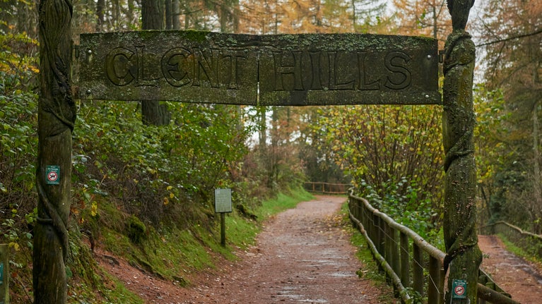
Head right up the hill on the path towards the wooden Clent Hills ARCHWAY.
Stage 2
Go under the ARCHWAY and continue on up the VIEWPOINT path.
Stage 3
Continue up to the TOPOSCOPE where the aluminium pictures are set in concrete.
Stage 4
Follow the way-markers to FIVE WAYS and the SCOTS PINES plantation, passing the trees on your left. Continue down across the plateau to the next SCOTS PINES plantation and on to the next junction.
Stage 5
Follow the way-markers to your left and continue on the path down towards DEEP WOOD and then turn left up a steep climb to a footpath at the top. Here you’ll see LOG PILE on your right.
Stage 6
Keep the LOG PILE on your right and head down the path towards BLUEBELL VALLEY.
Stage 7
Passing the site of the old RANGERS COTTAGE on your left, continue along the way-marked path through BLUEBELL VALLEY.
Stage 8
When you come to a wooden gate, go through it and follow this path and the way-markers all the way to another wooden gate . The gate will be on your right, and here you will turn left and follow the path.
Stage 9
Walk up the hill, following the way-markers and turn right where directed towards the HORSES MANE.
Stage 10
Go through the kissing gate at HOLLIS STONE and head downhill, where you will reach some steep steps at the bottom of the path.
End point
Before coming to the main road turn left, following the path through the woodland and back to the starting point.
Trail map

Get in touch
Nimmings Wood car park, Hagley Wood Lane, near Romsley, Worcestershire, B62 0NL