Crags Constitutional walk

A chance to explore a quieter part of Hardcastle Crags with dramatic cliffs, waterfalls and lovely beech woods. The route starts along the edge of a lovely mill dam and then stays very close to the stream where you should watch out for Dippers, Wagtails and Herons.
Watch your step
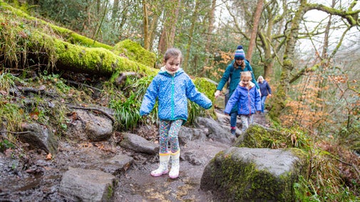
The route is on a stony path which is very uneven in several places. It is necessary to cross a stream using stepping stones which can quickly become unstable or slippery when water levels rise. Parts of the riverside section are likely to be muddy especially after rain, and there are some short inclines which can be slippery underfoot.
Total stages: 6
Total stages: 6
Start point
Gibson Mill, grid ref: SD972298
Stage 1
Starting at Gibson Mill, cross the bridge to the left of the Weaving Shed Café and then turn right onto the path alongside the river. Cross the stream using the stepping stones, taking care as these can quickly become unstable or slippery when water levels rise.
Stage 2
Follow the path which curves past the millponds and down some steps. Here, to your left, you will see the first example of our natural flood management interventions – several leaky dams which slow and disrupt the course of water as it runs downhill.
Stage 3
The path bends slightly to the left, passing a waterfall and over a small stone bridge before widening. To your right, you will see another natural flood management intervention – a large tree secured in place over the river. Continue to follow the path, passing a second large fallen tree which spans the width of the river.
Stage 4
The route then splits at a fork, with the left path (purple waymarker) continuing on to the Railway Trail. Head down the right path, following the green waymarker and the course of the river. Cross the bridge over the river, walk a short way, and then cross a second bridge back over.
Stage 5
Follow the path up a short incline, cross a small bridge over a stream and then down some steps which bring you right to the edge of the river. Cross the bridge next to the small stone hut and then follow the path up a short, steep hill. Turn right at the top, away from the bridge and public footpath sign.
Stage 6
The path follows a steady incline, levelling out and then passing through a wide gate. It then joins on to the main track which heads downhill back to Gibson Mill.
End point
Gibson Mill, grid ref: SD972298
Trail map

More near here

Railway Trail walk
A varied circular walk through woods, alongside the stream and dams with great views along the higher slopes. Watch out for bluebells in the Spring. Part of this route follow the old railway that was used to build the reservoirs on the tops.

Mill walk (riverside)
Walk from Hardcastle Crags' car park to Gibson Mill, and see how the stream changes along the route, looking out for weirs, wildlife and stepping stones – a fun way to get across to the other side.

Mill walk (upper woodland)
Watch for local wildlife on a quieter part of the Crags, weaving through a wonderful stand of pines and taking in views from the rocky outcrop Slurring Rock.
Get in touch
Gibson Mill, Midgehole Road, Hebden Bridge, West Yorkshire, HX7 7AW