Discover more of the Yorkshire Coast
Find out how to get to the Yorkshire Coast, where to park, the things to see and do and more.

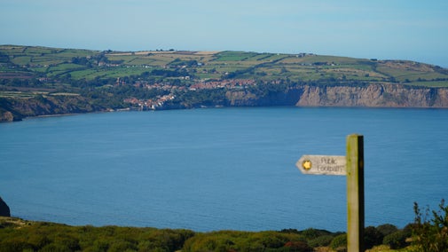
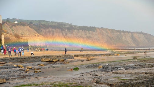
At first glance the Yorkshire Coast seems like a rugged natural landscape, created by time and tide. In fact, human history is a significant factor in the shaping of this landscape. A Second World War radar station and the impacts of the alum industry are among the stories to be discovered.
In the 16th century alum was essential in the textile industry as a fixative for dyes. Initially imported from Italy where there was a Papal monopoly on the industry, the supply to Great Britain was cut off during the Reformation. In response to this need Thomas Challoner set up Britain’s first alum works in Guisborough.
He recognised that the fossils found around Yorkshire's coast were similar to those found in the alum quarries in Europe. As the industry grew, sites along the coast were favoured as access to the shales and subsequent transportation was much easier.
Alum was extracted from quarried shales through a large scale and complicated process which took months to complete. The process involved extracting then burning huge piles of shale for nine months, before transferring it to leaching pits to extract an aluminium sulphate liquor. This was sent along channels to the alum works where human urine was added.
At the peak of alum production, the industry required 200 tonnes of urine every year, equivalent to the produce of 1,000 people. The demand was such that it was imported from London and Newcastle, buckets were left on street corners for collection and public toilets were reportedly built in Hull to supply the alum works.
This unsavoury liquor was left until the alum crystals settled out, ready to be removed. An intriguing method was employed to judge when the optimum amount of alum had been extracted from the liquor: when it was ready an egg could be floated in the solution.
The last alum works on the Yorkshire Coast closed in 1871. This was due to the invention of manufacturing synthetic alum in 1855, then subsequently the creation of dyes which contained their own fixative.
There are many sites along the Yorkshire Coast which bear evidence of the alum industry. These include Loftus Alum Quarries, where the cliff profile is drastically changed by extraction and huge shale tips remain.
Further south, at Ravenscar, the remains of Peak Alum Works are well preserved and enable visitors to visualise the processes which took place.

Ravenscar Chain Home Low Radar Station lies in a field on a cliff top just to the south of the village of Ravenscar near Scarborough, an area known as Bent Rigg.
Constructed as part of a coastal defence radar system in 1941, the station continued in use until after the Second World War. You can still see the intact remains of four brick buildings – a transmitter/receiver block, fuel store, engine house and a communications hut with a distinctive barrel shaped corrugated roof.
In the corner of the same field, the footings of a complex of about a dozen barrack blocks and other domestic buildings are visible, though it takes a little more imagination to picture them in their heyday.
Following the end of the war, the buildings were neglected for many years. It seems likely that most were demolished when the station was decommissioned, although one or two were kept, possibly for agricultural use. In this exposed and windswept spot livestock certainly appreciate any form of shelter.
Proposals for the demolition of these run-down buildings were seriously considered. Thankfully, their value has been better recognised in more recent times. They were surveyed by a volunteer and a National Trust Consultant Archaeologist in 2000; both the radar buildings and the remains of the barrack complex were given Scheduled Monument status by English Heritage in 2002.
A specialist contractor was employed to remove rubble and any remaining asbestos sheeting cemented into the concrete bases of the barrack block ruins. Interiors of the buildings also had to be cleared of sheep dung and other debris.
Chartered architects and archaeologists produced a draft archaeological survey. This included a photographic survey of the buildings and notable surviving features, such as blast shutters on transmitter/receiver block windows, as well as a feature-by-feature survey, a plan of the whole complex and other documentary research.
With buildings clear of debris, we undertook work to slow further decline of their condition and make them safe. A number of crumbling walls had to be repaired and reinforced or repointed and secure grilles fitted in each doorway.
You can find a series of information panels about the history of the buildings.
The station is situated next to the Cleveland Way National Trail and ‘Cinder Track’ route which follows the old Whitby–Scarborough railway line. Visitors are welcome to enter the field to take a closer look.
At the green signpost in the far-left corner of the square as you face the station sign, follow a narrow track which leads diagonally to the left of a flight of steps. Join the old railway track then bear left through a gate and continue for approximately one mile. Look out for an interpretation panel and stile accessing the field on your left.
Learn more by viewing our interpretation boards online.
Please note, the field may be muddy following wet weather. Sensible footwear is advised.
For a circular walk, leave the field on the opposite side, turn left and follow the Cleveland Way back to the village.
Limited roadside parking is available in Ravenscar's Station Square. Livestock often graze here, so please keep dogs on a lead.

Find out how to get to the Yorkshire Coast, where to park, the things to see and do and more.
Find out what the Yorkshire Coast has to offer, from fossil hunting and walking routes, to the villages that reveal the human history of this wild landscape.

Discover what family-friendly activities are on offer at the Yorkshire Coast, from cycling and birdwatching to fossil hunting and rockpooling on the beach.

Learn about people from the past, discover remarkable works of art and brush up on your knowledge of architecture and gardens.

Learn more about the role of Ravenscar's radar buildings during the Second World War.