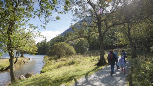
Corpse road and tumuli walk

Get under the skin of the Cumbrian landscape on this trail through a patchwork of natural and archaeological features.
Discover layers of history
See a traditional farm, walk along an ancient corpse road and discover evidence of human activity dating from the Bronze Age to the Second World War.
Total stages: 7
Total stages: 7
Start point
Maggie's Bridge car park, grid ref: NY134210
Stage 1
Start at Maggie's Bridge car park in Loweswater. Go through the gate opposite and follow the track up to High Nook farm, where you will see fine examples of traditional Cumbrian farm buildings.
Stage 2
Leave the farmyard through the gate and bear slightly left. Follow this wide gravel track up towards High Nook Tarn and take the path veering right.
Stage 3
You are now on part of the corpse road that leads from Buttermere to Lamplugh church, and onwards to St Bees Priory. Follow this parallel to the wall and be sure to take in the great views when a gap in the woodland appears.
Stage 4
Go through a small gate in the woodland wall and follow the steep, narrow downhill track. When you reach a wider forestry track, turn left.
Stage 5
It's worth pausing here to look at Holme Force waterfall and the single span stone bridge that crosses Holme Beck. Follow the forest track downwards until you meet another intersecting track.
Stage 6
Follow the narrow track towards the lakeshore and turn right. You will come across a rectangular platform on your left. This dates from the Second World War, when cables were stretched across the lake, with the intention of thwarting any German sea-planes attempting to land here.
Stage 7
As you near the Bothy (our camping barn) you may notice two burial mounds near the path. Continue out of the woods and across the hay meadows back to the car park.
End point
Maggie's Bridge car park, grid ref: NY134210
Trail map

More near here

Lanthwaite Wood and Crummock Water walk
Explore the hills and woodlands on the eastern side of Crummock Water on this circular walk near Buttermere, Lake District.

Buttermere to Rannerdale walk
This scenic and invigorating Lakeland ridge walk takes you from the Buttermere Valley up to the summit of Rannerdale Knotts, offering impressive views over lakes and high peaks.
Get in touch
Our partners

We’ve partnered with Cotswold Outdoor to help everyone make the most of their time outdoors in the places we care for.
You might also be interested in

Walking in the Lake District
From gentle ambles to more challenging hikes, these are some of the best walks to explore the heart of the Lake District.

Walking
Explore some of the finest landscapes in our care on coastal paths, accessible trails, woodland walks and everything in between. Find the best places to walk near you.

Things to do in Buttermere Valley
Explore the Lake District's Buttermere Valley and discover walks through rugged landscapes, panoramic views, thundering waterfalls and other forces of nature.

Wildlife in the Buttermere Valley
Discover the wildlife you can spot in the Buttermere Valley. Learn how otters have returned and how rangers care for swathes of bluebells to protect them for future generations.

Follow the Countryside Code
Help to look after National Trust places by observing a few simple guidelines during your visit and following the Countryside Code.

Staying safe at National Trust places
The special places in National Trust care sometimes come with a few risks for visitors, be it coastline or countryside. Find out how to keep safe throughout your visits.

Cotswold Outdoor: our exclusive walking partner
Learn about the National Trust’s ongoing partnership with Cotswold Outdoor. Find out how they help us care for precious places and the exclusive discount available for National Trust supporters.