Brimham Rocks to Pateley Bridge circular walk

This circular walk takes you from dramatic moorland rock formations by the River Nidd to Pateley Bridge, returning via the Nidderdale Way, an area of outstanding natural beauty.
Total stages: 6
Total stages: 6
Start point
Brimham Rocks car park; SE208645
Stage 1
Brimham Rocks to Smelthouses (2.3 km/1.4 miles) From the Brimham Rocks car park, go down the road you came in on, but before reaching the public road turn right down the track marked Private Road to Druids Cave farm. After about 75m – and just before the track passes between a gap in a wall with a National Trust boundary marker – there’s a footpath to your left. Take this path and then the right fork, continue keeping the wall just on your right. In about 350m the ground will dip down sharply to a farm track with a gate to your right with a public bridleway sign. Take the stile on the left of the gate. Keep straight on the main path – ignoring stiles and paths to the right and left – for about 1.2 km until you reach a farm track. Through the gate and turn left past the tiny cottage, Artist's Retreat. The track is signposted Public Bridleway/Smelthouses. Continue for 240 m until you reach a road, turn right here.
Stage 2
Smelthouses to Glasshouses (2.7 km/1.7 miles) After 250m near the bottom of a dip in the road, just past a letterbox and before a bridge over the beck, look out for a track on your left signposted Public Bridleway to Low Laithe. Follow the track, keeping straight on where the track forks left to Knox Hall. At the road go straight across to the signposted public footpath – ignoring any signs saying Private – and then down the grassy slope. Follow the path over the beck on a wooden footbridge and continue over a stile to the bank of the River Nidd. Turn right beside the river and follow the path. In a little over 500m you’ll pass under an old railway bridge, and in another 1.5 km or so you’ll reach the road in Glasshouses.
Stage 3
Glasshouses to Pateley Bridge (1.9 km/1.2 miles) Near the road bridge on the same side of the river you’ll find a path signposted Public Footpath to Pateley Bridge. Take this path passing Glasshouses Dam on your left, and soon after look out for the weir where the path returns to run beside the river. Stay on the path beside the river all the way – ignoring any paths to your right – until you reach the road bridge at Pateley Bridge and turn right. Looking towards the High Street and to your right there’s a car park with public toilets. Enjoy some refreshments at one of the many places in the town – there won’t be another opportunity before getting back to Brimham Rocks.
Stage 4
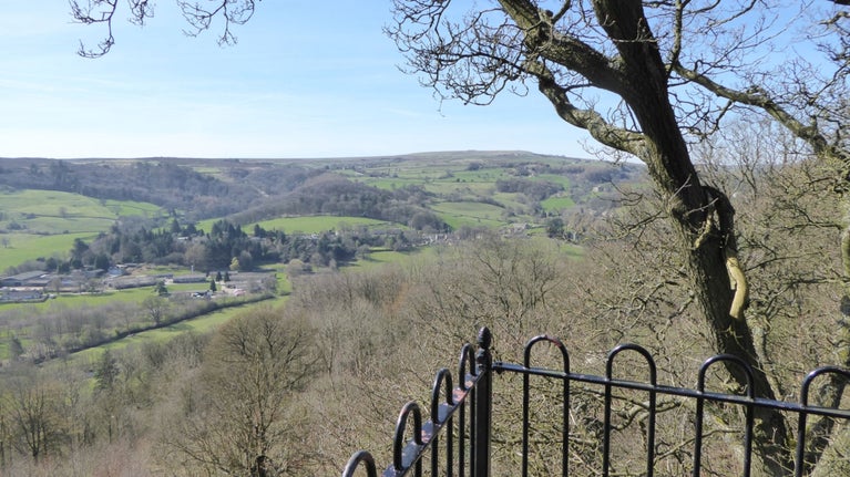
Pateley Bridge to Blazefield (2.4 km/1.5 miles) Head up the High Street, following Ripon Road round to the right at the top. In about 200m just past the Methodist church on the right, look out on the left for a blue signpost to Panorama Walk and continue up the steps. At the top of the steps follow the Panorama Walk path up the hill running parallel to the road. When you reach the cemetery gates on your left, go straight on up the track with a 6’6” width traffic sign on its right-hand side. After about 250m there’s a gate on the right, which leads to a viewpoint built in 1887 in celebration of Queen Victoria’s Golden Jubilee. There’s a bench to rest from the climb, lovely views across the Nidd valley, and an interesting local history information board. Continue up the path for another 350m or so until you reach the top, where there are houses left and right. Continue straight on the track signposted Hole House, Nidderdale Way and Blazefield. In about 400m you’ll reach a footpath T-junction, take the right-hand path leading down for about 200m until you get to a road. Turn left up the road, and just as it’s beginning to bend right, take the track to the right that runs behind the terrace of houses at Blazefield. It’s signposted Nidderdale Way and Sandy Lane. Follow this track until you reach a road after 300m.
Stage 5
Blazefield to Whitehouses (1.6 km / 1 mile) Turn left on to the road following the sign to the Nidderdale Way. At the top of the hill where the road bends sharp left, take the walled footpath straight ahead. Reaching a road, step over the small ford and turn right down the road. After 150m – immediately after a right-hand hairpin bend – turn left onto the track signposted Public Footpath Brimham Rocks & Nidderdale Way. Follow the path to the left of the entrance to the Llama Trekking Centre, continuing straight on. At the Whitehouses crossroad of tracks go straight on to a public bridleway signposted to Ripon Road/Nidderdale Way. After 250m you’ll reach a footpath to the right immediately before a row of cottages signposted to Brimham Rocks & Nidderdale Way.
Stage 6
Whitehouses to Brimham Rocks (2.6 km / 1.6 mile) Take the path past the end of the cottages and keep straight on beside the wall on your right. After the meadows follow the footpath markers to a farm track and bear left. Over a cattle grid, take the second track to your right down to the footbridge over Fell Beck. Immediately after the footbridge do not go over the stile, but turn right beside the beck. After a short winding climb, at a fork take the right-hand path signposted Smelthouses. Continue to a stile through a wall, then after 75m turn left on a path with the yellow footpath marker. Up the path between the farmhouse and a meadow and turn right onto the farm track. Follow the track for 1.5km and you’ll reach the Brimham Rocks entrance road, which you can follow back to the car park. Head up to the visitor centre for a refreshing drink and snack.
End point
Brimham Rocks car park; 54.0766, -1.6827
Trail map

More near here

Circular walk at Brimham Rocks
This short walk will show you the highlights of Brimham from the dramatic rock formations, to the heather moorland.
Get in touch
Brimham Moor Road, Summerbridge, Harrogate, North Yorkshire, HG3 4DW
Our partners

We’ve partnered with Cotswold Outdoor to help everyone make the most of their time outdoors in the places we care for.
You might also be interested in

Exploring Brimham Rocks
From rocks to moorland, Brimham offers a whole host of different features for visitors to explore. Here are a few highlights and what not to miss on your first, second or thousandth visit.

Outdoor activities at Brimham Rocks
There are plenty of ways to explore Brimham Rocks, from walking and cycling, to orienteering and geocaching. Discover the outdoor activities on offer.

Eating and drinking at Brimham Rocks
Looking for some refreshment during your visit to Brimham Rocks? You can find a selection of food and drinks at the refreshment kiosk open open everyday 10am - 3.30pm. Every bite of a sausage roll or crunch of an ice-cream cone helps to protect this special place.

Walking in Yorkshire
Discover some of the best walks in Yorkshire, from rugged Pennine beauty spots, views over the coast, to parkland and meadows perfect for a family stroll. Most are dog friendly and many can be enjoyed as part of your day out to the nearest National Trust property.

Cotswold Outdoor: our exclusive walking partner
Learn about the National Trust’s ongoing partnership with Cotswold Outdoor. Find out how they help us care for precious places and the exclusive discount available for National Trust supporters.

Walking
Explore some of the finest landscapes in our care on coastal paths, accessible trails, woodland walks and everything in between. Find the best places to walk near you.

Staying safe at National Trust places
The special places in National Trust care sometimes come with a few risks for visitors, be it coastline or countryside. Find out how to keep safe throughout your visits.

Follow the Countryside Code
Help to look after National Trust places by observing a few simple guidelines during your visit and following the Countryside Code.