Roseberry Topping from Great Ayton station walk

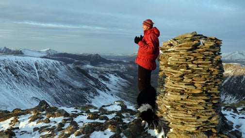
This walk starts at Great Ayton station and takes in many of the features that make Roseberry Topping so special. Discover fascinating history, fabulous wildlife and the 360° panoramic views that can be enjoyed from the summit.
Total stages: 12
Total stages: 12
Start point
Great Ayton station, grid ref: NZ574107
Stage 1
Turn right on leaving the station and follow the road, taking care near the traffic.
Stage 2
Turn left at White House Farm and follow the road uphill to Airy Holme Farm.
Stage 3
Go through the farmyard. Turn right at the end of the yard to continue on the track.
Stage 4
After 765yd (700m) turn left onto a footpath. Cross a stile and continue towards Roseberry Topping.
Stage 5
At the top of the field, cross another stile. Continue forward onto a stone-pitched path that leads to the summit.
Stage 6
Retrace your steps back down to the stile. Do not cross the stile, but turn right and follow the fence line down. Go through the gate and follow the path through the field to the right of the folly.
Stage 7
Go through the gate into Newton Wood. Turn left and follow the path along the top edge of the wood.
Stage 8
After passing through a clearing, bear left where the path forks.
Stage 9
Go right at the T-junction and follow the path down through the woods.
Stage 10
Where the path leaves the wood, turn left onto a wide track and continue for 55yds (50m).
Stage 11
Take the left-hand fork at the National Trust sign. Continue straight on into Cliff Ridge Wood, sticking to the right when the path forks again.
Stage 12
At the end of the path, leave the wood through a kissing gate. Follow the path on the right hand side of the fence across the field. Cross the stile and turn right on the road. Retrace your steps back to the station.
End point
Great Ayton station, grid ref: NZ574107
Trail map

More near here

Roseberry Topping and Captain Cook's Monument walk
Discover this 7.2 mile loop starting at Great Ayton, taking in Captain Cook's Monument then heading to the summit of Roseberry Topping for 360-degree views.

Scarth Wood Moor loop and Mount Grace Priory
A moderate loop from Scarth Wood Moor near Osmotherly to Mount Grace Priory. Be inspired by scenic woodland, moorland, a reservoir and a picturesque village en route.

Old Saltburn to Warsett Hill walk
Follow the Old Saltburn to Warsett Hill walking trail on the Yorkshire Coast and enjoy the seaside wildlife, iron stone mining remains, sculptures and wild flowers.
Get in touch
Our partners

We’ve partnered with Cotswold Outdoor to help everyone make the most of their time outdoors in the places we care for.
You might also be interested in

Things to see and do at Roseberry Topping
Discover what you can do around Roseberry Topping, from climbing the hill itself to seeing geological formations at Cliff Rigg Quarry and spotting wildlife such as roe deer.

Cotswold Outdoor: our exclusive walking partner
Learn about the National Trust’s ongoing partnership with Cotswold Outdoor. Find out how they help us care for precious places and the exclusive discount available for National Trust supporters.

Follow the Countryside Code
Help to look after National Trust places by observing a few simple guidelines during your visit and following the Countryside Code.

Staying safe at National Trust places
The special places in National Trust care sometimes come with a few risks for visitors, be it coastline or countryside. Find out how to keep safe throughout your visits.

How to stay warm on a winter walk
Don’t let the cold weather put you off exploring winter landscapes and getting out into the crisp air. Keep warm on your next winter walk with these top tips and kit ideas.

Walking
Explore some of the finest landscapes in our care on coastal paths, accessible trails, woodland walks and everything in between. Find the best places to walk near you.

Walking in Yorkshire
Discover some of the best walks in Yorkshire, from rugged Pennine beauty spots, views over the coast, to parkland and meadows perfect for a family stroll. Most are dog friendly and many can be enjoyed as part of your day out to the nearest National Trust property.