Discover more on the Solva Coast
Find out how to get to the Solva Coast, where to park, the things to see and do and more.

Discover the hidden history of the Solva Coast and see evidence of the past that helps tell the stories of the people who once lived and worked in this area of Pembrokeshire.
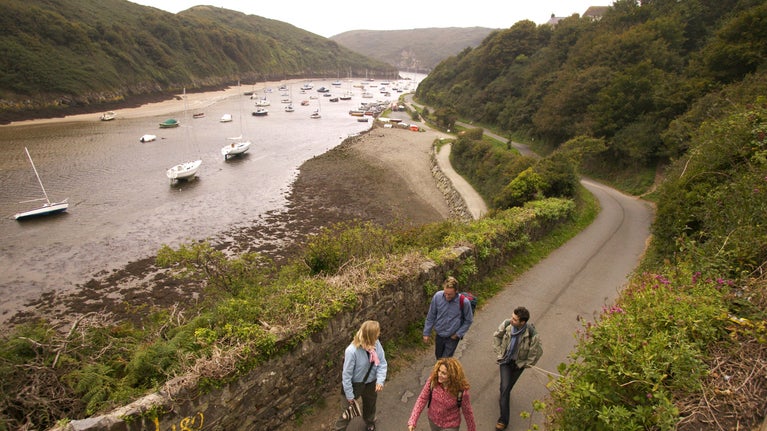
The harbour at Solva became the main connection for this remote village before the road was built.
You can find multiple lime kilns along the edge of the harbour. These are best viewed from the path or get a closer look at low tide. They’re thought to be at least 200 years old.
Limestone was heated here to create quicklime. During the 1800s lime was widely used as a building material and as a soil improver on local farms. Limestone and coal were both transported to the harbour in flat-bottomed boats. These were then unloaded onto carts at low tide and moved the short distance to the kilns.

The Pembrokeshire county has around 50 Iron Age forts scattered across the coast. We care for half of them, including the three promontory forts of note that you’ll find near Solva at the Gribin, Porth y Rhaw and Dinas Fawr.
Built with their backs to the sea to defend them from attacks from the land, they were occupied over two thousand years ago. Coastal erosion has worn away most of the land the ramparts used to guard, except at the Gribin, which is sheltered by the headlands on either side.
Just beyond Porth y Rhaw is the Nine Wells Valley. This is a steep-sided valley that runs all the way down to the sea. There were originally two mills here that were used for corn and cloth. Both of these mills closed during the First World War in 1915. Take a look around as the foundations for both these buildings can still be seen today.
There have been many shipwrecks along this treacherous coast. The ships named Phoebe and Peggy were bound from Philadelphia to Liverpool in 1776. During storms they were wrecked very close to the entrance of Solva Harbour.
All the crew from these ships drowned along with several local boatmen from Solva who were trying to rescue them.
Smalls lighthouse stands on a dangerous reef known as The Smalls approximately 20 miles west of Marloes Peninsula and eight miles west of Grassholm island. The original lighthouse was created in Solva harbour during 1776 and towed into position by a barge. It stood on nine oak pillars, allowing the sea to pass through beneath.
Although the force of the sea rocked it in bad weather it stood for 80 years before it needed replacing. The lighthouse is known for having brought about a change in lighthouse policy in 1801 following a gruesome episode involving lighthouse keepers Thomas Howell and Thomas Griffith.
The two-person team were known to quarrel. When Griffith died in an accident, Howell feared he might be accused of murder if he discarded the body at sea. So Howell built a basic coffin and attached it to the outside of the lighthouse until the next relief boat arrived.
However, bad weather made the rudimentary box break apart and the body was thrown against the window with force. Incredibly, Howell still managed to keep the lighthouse lamp lit until help eventually arrived.
When Howell was finally relieved of duty, it was apparent that the impact of the situation had affected him deeply, and as a result lighthouse policy was changed so that lighthouse teams were never less than three people. This continued until the automation of British lighthouses in the 1980s.
The story has been the inspiration for many films and documentaries and the reef was the location where Captain TH Sumner discovered the concept of celestial position lines, or circles of equal altitude, which formed the basis of nearly all modern celestial navigation and were sometimes called Sumner lines.

Find out how to get to the Solva Coast, where to park, the things to see and do and more.
Discover the flora and fauna of St David’s Peninsula. Look out for coastal plants and spot kestrels and gannets soaring overhead, or stonechats perched on gorse bushes.

Uncover the industrial heritage of the pretty little harbour, savour the seaside scenery and enjoy outdoor activities on land and in the water.

Discover more about the St David’s Celtic origins, pilgrimages and patron saint and how the area’s prehistoric past has left its mark on Britain’s smallest city.
